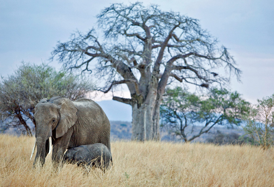
The Shira Route is a difficult route that begins in the west, at Shira Gate. What is unque about Shira is that the first section of the trail is not hiked, but rather driven. Therefore, climbers using Shira will miss out on hiking up one of Kilimanjaro’s ecological zones, the rain forest.Shira Route starts at 3,600 meters and is therefore not ideal for trekkers who have little or no experience of high altitude trekking.The Shira Route is practically identical to the Lemosho Route. In fact, Shira was the original route before Lemosho was created to improve the route start point.Whereas Lemosho Route starts at the Londorossi Gates, the Shira Route bypasses this and begins further north and higher up at the Shira Gate. On the first day hikers trek from Shira Gate to Simba Camp which is at a very similar altitude, allowing trekkers to acclimatise before joining the Lemosho Route on day two at Shira Camp 2.
On arrival from KIA we transfer to your hotel in Moshi town. You`ll have a short time to freshen up, and then have a briefing. Our guide will give you a briefing and ensure that you have all the gear required for the climb. If you are missing essential equipment it can be rented for very cheap prices.
The Shira Route begins at Londorosi Gate (2,100 meters) in the West, the same start point as the Lemosho Route. The drive to Londorosi Gate takes approximately three hours from Moshi and considerably longer from Arusha. Registration with the Kilimanjaro National Park authorities occurs at the gate and then you will be driven further up the mountain to the trailhead starting point at Morum barrier. Most tour operators serve lunch here before the short first day trek to Simba Camp (3,680 meters) begins. You may get lucky and spot large wildlife like elephant and buffalo that sometimes emerge from the rainforest onto the path as you trek towards your first camp. Dinner will be served when you reach Simba Camp.
Estimated Trekking time: 2-3 hours
Estimated Trekking distance: 4km / 2 miles
Zone: Rainforest zone
Activities: Hiking/Trekking
Accommodation & Meals: Simba Camp (3,680 meters). B, L, D.
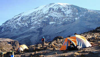
Day two starts with a gradual hike through the final stretch of the rainforest zone and then gets steeper as you approach the low alpine moorland zone. The trek is a long one that stops briefly for lunch at Shira Camp 1 which is on the western edge of the Shira Plateau; just over 8km from your starting point. You then continue on your hike across and up the Shira plateau to Shira Camp 2 at 3,850 meters. Here you will join trekkers from the Machame Route whilst enjoying stunning view across the valley below and Western Breach of Kilimanjaro above. The plateau is exposed so be prepared for a cold night with temperatures getting below zero.
Estimated Trekking distance: 6km / 4 miles
Estimated Trekking time: 2-4 hours
Zone: Rainforest zone/ Low Alpine Zone
Activities: Hiking/Trekking
Accommodation & Meals: Shira Camp 2 (3,850 meters). B, L, D
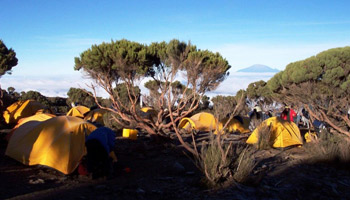
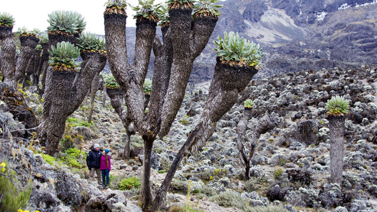
On day three you will start trekking due east from the Shira Plateau, passing through the ‘Garden of the Senecios’ which also features many giant lobelias. The landscape rapidly becomes desert-like as you approach Lava Tower and the Shark’s Tooth formation at 4,600 meters. You will have lunch at Lava Tower before joining the Southern Circuit trail which descends to Baranco Camp 3,900 meters where you will spend the night at a very similar elevation as the night before. Climbing high and sleeping low is a good way to acclimatize the body to altitude. Note: some tour operators offer variations of this route via Moir Camp just north of Lava Tower, before joining the Southern Circuit.
Estimated Trekking distance: 11km / 7 miles
Estimated Trekking time: 6-8 hours
Zone: Rainforest zone/ High Alpine Zone
Activities: Hiking/Trekking
Accommodation & Meals: Baranco Camp (3,900 meters). B, L, D.
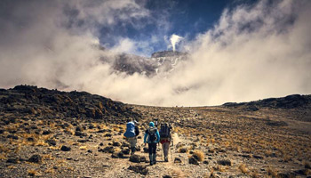
After breakfast, we continue up a steep ridge to the great Baranco Wall, and then you climb this imposing obstacle, which turns out to be easier than it looks. Topping out just below the Heim Glacier, you can now appreciate just how beautiful Kilimanjaro really is. With Kibo’s glaciers soaring overhead, you descend into the lush Karanga Valley to the Karanga Valley campsite for hot lunch. From the camp, you can look east and see the jagged peaks of Mawenzi jutting into the African sky.
Estimated Trekking distance: 4.5km / 3 miles
Estimated Trekking time: 3-4 hours
Zone: Low alpine zone / High alpine zone
Activities: Hiking/Trekking
Accommodation & Meals: Karanga Camp (3,960 m). B, L, D.
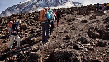
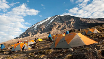
After breakfast, we leave the camp and continue to the Base camp (Barafu). The last water on the route is in the Karanga Valley; there is no water at Barafu Camp, even though Barafu is the Swahili word for “ice.” The famous snows of Kilimanjaro are far above Barafu Camp near the summit of the mountain. Your tent will be pitched on a narrow, stony, wind-swept ridge, so make sure that you familiarize yourself with the terrain before dark to avoid any accidents. Prepare your equipment and warm clothing for your summit climb, and drink a lot of fluids. After an early dinner, go to bed for a few hours of precious sleep.
Estimated Trekking distance: 5.5km / 3 miles
Estimated Trekking time: 3-5 hours
Zone: High alpine zone
Activities: Hiking/Trekking
Accommodation & Meals: Barafu Camp (4,680 meters). B, L, D.
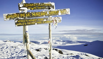
Day five starts at midnight with hot tea, biscuits and a long and zigzagging hike up the heavy scree that covers the steep slopes of Kibo. The going is slow and very tough. You will need to dig deep and ensure you maintain a consistent pace to push yourself up to the crater rim. After about 4-6 hours hiking you will reach Stella Point (5,739 meters) where you will have a chance to rest and watch dawn break across the Tanzanian landscape. It is a good idea to have some hot tea or hot chocolate at this point as you will need to muster the energy to continue for another 1-2 hours around and up the crater rim to Uhuru Peak (5,895 meters). Remember to keep your momentum moving forward, one step at a time. Over 60% of climbers stop at Stella Point but most can make it to the summit if they are able to find the metal strength to push through. Obviously if you are experiencing severe AMS symptoms you should descend immediately. Your time at Uhuru Peak will be brief. Take as many pictures as you can, savor your accomplishment and then start heading back to Stella Point. Many trekkers slide down the scree slopes of Kibo to Barafu Camp, where you will have a chance to rest before continuing on to Mweka Camp (3,100 meters). In total you will be trekking between 12-16 hours on day 5 so it is really important that you pace yourself and remain hydrated.
Estimated Trekking distance: 4.5km / 3 miles ascent and then 11km / 7 mile descent
Estimated Trekking time: 6-8 hours to the summit and then 5-8 hours to Mweka
Zone: Glacial zone and the all preceding zones
Activities: Hiking/Trekking
Accommodation & Meals: Mweka Camp (3,100 meters). B, L, D.
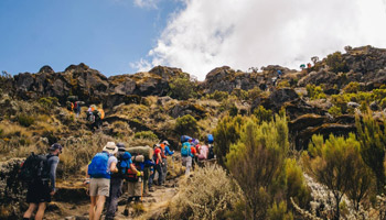
The final day on the mountain is a short one, but nonetheless tiring as your body will be exhausted and your knees will likely be sore from the previous day’s descent. Go slowly and enjoy the wonderful rainforest scenery as you head towards Mweka Gate (1,640 meters). At the gate you will need to sign-out with the authorities and will also receive your certificate, either for Stella Point or for Uhuru Peak. It is customary to pay your tips to your trekking team before you depart back to your hotel in Arusha
Estimated Trekking distance: 9km / 6 miles
Estimated Trekking time: 3-5 hours
Zone: GRainforest zone
Activities: Hiking/Trekking
Accommodation & Meals: Arusha Gold Crest Hotel, B, L.
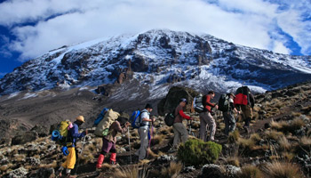
Transfer to Kilimanjaro airport for your return flight, B. or Proceed with safari with us
Customize your Trip with choose a Tailor-Made destination, pick your lodges, and we'll do the rest
